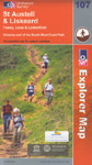
 | Ordnance Survey Map 107
St Austell and Liskeard
Explorer Map also covering Fowey, Looe and Lostwithiel and parts of the Saints' Way, South West Coast Path and Camel Trail. Explorer maps are suitable for the walker, cyclist and motorist and show public rights of way, the South West Coast Path, and tourist information. Adjacent maps 105, 106,108 and 109 are held in stock, other maps may be available by special order.
Scale 1:25,000, 4cm to 1km or 2inches to 1 mile.
Click on the image to enlarge it.
Price: £7.99
|
|
 |
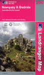 | Ordnance Survey Map 200
Newquay and Bodmin
Landranger Map also covering Fowey, Lostwithiel, Padstow, Wadebridge, Camelford and St Austell. An ideal touring map for the motorist, showing public rights of way, the South West Coast Path, and tourist information. Adjacent maps 201 and 204 are held in stock, other maps may be available by special order.
Scale 1:50,000, 2cm to 1 km or 1¼ inches to 1 mile.
Click on the image to enlarge it.
Price: £6.99
|
|
|
|
|
|
|
|
|
|
|
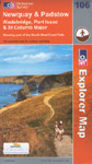 | Ordnance Survey Map 106
Newquay and Padstow
Explorer Map also covering Wadebridge, Port Issac and St Columb Major and parts of the South West Coast Path, Saints' Way and Camel Trail. Explorer maps are suitable for the walker, cyclist and motorist and show public rights of way, the South West Coast Path, and tourist information. Adjacent maps 104, 105, 107 and 109 are held in stock, other maps may be available by special order.
Scale 1:25,000, 4cm to 1km or 2inches to 1 mile.
Click on the image to enlarge it.
Price: £7.99
|
|
|
 | Ordnance Survey Map 108
Lower Tamar Valley and Plymouth
Explorer Map also covering Tavistock, Callington, Saltash and Torpoint and parts of the Dartmoor Way, West Devon Way, Plymouth Cross-City Link and South West Coast Path as well as the Tamar Valley Discovery Trail. Explorer maps are suitable for the walker, cyclist and motorist and show public rights of way, the South West Coast Path, and tourist information. Adjacent maps 107, 109 and 112 are held in stock, other maps may be available by special order.
Scale 1:25,000, 4cm to 1km or 2inches to 1 mile.
Click on the image to enlarge it.
Price: £7.99
|
|
|
 | Ordnance Survey Map 109
Bodmin Moor
Explorer Map also covering Bodmin, Camelford and Liskeard and parts of the Camel Trail and South West Coast Path as well as Inny-Valleys Walk, Moorland Walk, Watermill Walk, Camelford Way and Two Valleys Walk. Explorer maps are suitable for the walker, cyclist and motorist and show public rights of way, the South West Coast Path, and tourist information. Adjacent maps 106, 107, 108, 111 and 112 are held in stock, other maps may be available by special order.
Scale 1:25,000, 4cm to 1km or 2inches to 1 mile.
Click on the image to enlarge it.
Price: £7.99
|
|
|
|
|
|
|
|
|
|
|
|
|
|
|
|
|
|
|
|
|